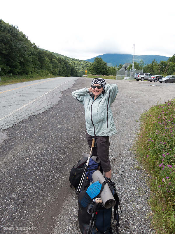
DF: The rain stopped around midnight. The wind picked up, and it was quite chilly (50 degrees or so). The morning was foggy, and still cold and windy. We packed up everything, then put on our cold, wet hiking clothes and began our run for the border.
It was a fairly short hike: two miles up and over Burnt Mountain (2600 ft) to a road crossing at North Jay Pass, then 2.6 miles up and over Carleton Mountain (2670 ft) to the border. But then we had to turn around and go back the 2.6 miles to the road to hitch into town. That’s 7.2 miles, if you’re keeping track.
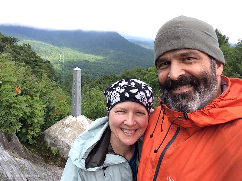
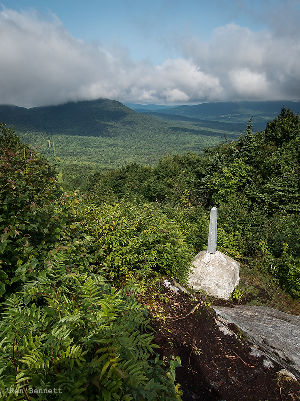
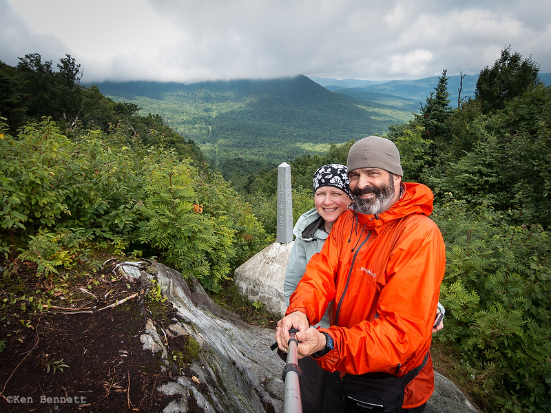
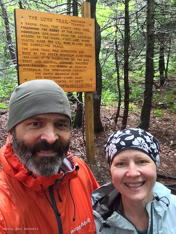
The weather was chilly, windy, and foggy for most of the trip. Just before we got to the border, the sun started peeking through. It was pretty cool to get to the sign announcing that we were at the northern terminus. We stepped out of the woods into the border clearing and took more pictures at the border marker. There’s a 100-foot swath of land along the border that’s been cleared of trees, kind of like a power line cut.
As we were getting ready to leave, a man hiked down the trail from the parking lot–a southbound section hiker just beginning his journey. We talked for a few minutes, then set off together.
He quickly pulled ahead and we finished our journey alone. The trip back to the road was more pleasant, since the sun had mostly come out and our clothes were beginning to dry (so we weren’t as cold).
We caught a ride fairly quickly from Dan. He said he was traveling for work, but he’s a hiker and he likes to help hikers when he can. He dropped us off in downtown Richford.
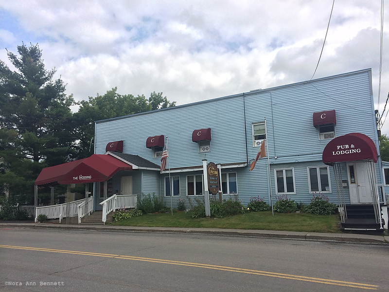
Richford is an interesting place. It reminded me of all the little former steel towns near Pittsburgh–lots of boarded up storefronts downtown and lots of older people, but not many younger ones. There used to be industry here, including a furniture manufacturer and a paper mill, but it doesn’t look like there’s a whole lot here anymore.
Our home for the night is a restaurant/banquet hall/motel. We had a great hot roast beef sandwich in the pub for lunch, and a fancy, if old-fashioned, steak dinner. In between, we walked downtown to make sure we knew where to catch the bus to St. Alban’s in the morning. We also packed our packs for bus and train travel–completely different than backcountry travel.
BC: Canada! Easy two miles to the road, then a slightly tougher 2.6 to the border. The sun finally came out at the border and we got some photos, then headed back south to Rt 105 for an easy hitch into Richford.

I read through your entire series of posts on this trip the other day and wanted to stop back to say thanks for posting. Your account of your trip seemed a bit more honest than most in describing the challenges. Kneemonia is making me delay my LT I’d planned for this September but reading your account makes me more determined than ever to do it when I can. Thanks again for sharing your adventure!
LikeLike
Thanks for the note, and I hope your knee gets better quickly!
LikeLike
Great journal. Trying my hand at it this August before my final year of school. Doing it solo so I hope I can keep myself sane/entertained.
LikeLike